Tools overview
All drawing tools and editing modes at a glance.
Element Editor organises its capabilities into two groups: drawing tools that create new features, and editing modes that operate on existing ones. The sections below give you a quick reference; each tool and mode has its own detailed page.
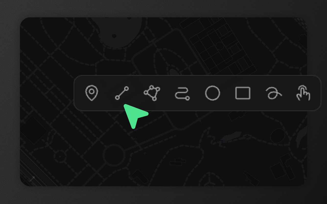
Drawing tools
| Tool | Default key | Produces | Personality |
|---|---|---|---|
Area ('polygon') | G | Polygon | Versatile |
| Line | L | LineString | Straightforward |
| Point | P | Point | Minimal |
| Rectangle | R | Polygon (_drawType: 'rectangle') | Principled |
| Circle | O | Polygon (_drawType: 'circle') | Existentially complicated |
| Freehand | F | LineString or Polygon (simplified) | Chaotic good |
| Route | C | LineString (_drawType: 'route') | Opinionated |
| Picker | X | The OpenStreetMap shape you click | Borrowed |
Note: Default keys are configurable. Press
Kto open the shortcuts panel and remap any tool key. The keys above reflect factory defaults; your users may have changed them.
Editing modes
| Mode | Activation | What it does |
|---|---|---|
| Vertex editing | Double-click feature or Enter | Drag, insert, and delete individual coordinates |
| Transform | A | Scale and rotate selected features |
| Selection | Click / Shift+click / Shift+drag | Select one or more features for further operations |
| Snapping | Active automatically (configurable) | Constrains cursor to nearby vertices and edges while drawing or editing |
| Boolean operations | Union, subtract, intersect, exclude: their own buttons next to the editing toolbar, with 2+ areas selected (union also joins 2+ lines). Cut hole (H) and slice (J): editing toolbar, with exactly 1 area selected | Union, intersect, subtract, exclude, cut hole, slice |
| Measure | M | Measure distances and areas without adding features to the map |
Geometry processing tools
These tools modify the geometry of a selected feature.
| Tool | What it does |
|---|---|
| Buffer | Expand or contract a polygon, or turn a line into a corridor polygon, by a fixed distance (−500 m to +2,000 m; lines 0 m up) |
| Simplify | Reduce vertex count using the Ramer–Douglas–Peucker algorithm |
| Smooth | Round and soften a polygon or line by adding vertices (1–5 passes) |
| Break apart | Split a Multi* or GeometryCollection feature into one feature per part |
| Merge | Combine 2+ same-type features into a single Multi* feature |
The editing toolbar adapts to the current selection — only relevant actions appear:
- Point selected → Duplicate, Delete
- MultiPoint / GeometryCollection selected → Transform, Break apart, Duplicate, Delete
- LineString / MultiLineString selected → Transform, Simplify, Smooth, Buffer, Duplicate, Delete (plus Break apart on Multi*)
- Polygon / MultiPolygon selected → Transform, Cut hole, Slice, Simplify, Smooth, Buffer, Duplicate, Delete (plus Break apart on Multi*)
- Multiple features selected → Transform, Merge, Duplicate, Delete, plus Union / Subtract / Intersect / Exclude unless they are all points (subtract, intersect and exclude need all areas)
Detailed pages
- Drawing tools — how each of the 8 tools works, output geometry, constraints
- Vertex editing — moving, inserting, and deleting coordinates
- Transform — scale and rotate
- Selection — single, multi, lasso, context menu
- Boolean operations — union, intersect, subtract, cut hole, slice
- Geometry processing — buffer, simplify, smooth, break apart, merge
- Measure — distance and area measurement overlay
- Snapping — snap targets, radius, toggling
- Import and export — file, paste, Google Sheets helpers
- Data table — spreadsheet view of features and properties
- Keyboard shortcuts — complete shortcut reference, remapping
The _drawType foreign member
Three tools — rectangle, circle, and route — produce standard GeoJSON geometry types (Polygon or LineString) but attach a _drawType foreign member to record the original drawing intent. Element uses it to warn before an edit would turn the shape into a plain polygon or line (vertex edit on a circle, rectangle or route; route alignment warnings when transforming). The first committed point change removes the tag.
{
  "type": "Feature",
  "geometry": { "type": "Polygon", "coordinates": [[...]] },
  "properties": {},
  "_drawType": "circle"
}Do not strip _drawType when round-tripping data through a backend. Without it, Element treats the shape as a plain polygon and removes the associated constraints.